
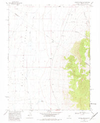
1969 Map of Moorman Spring NE
USGS Topo · Published 1971About this map
The White River Valley defines this high-desert landscape at the intersection of Nye, White Pine, and Lincoln counties. During the late 1960s, this area supported an active ranching and resource economy evidenced by numerous remote water sources and cattle infrastructure. The presence of the Sheep Pass Corral and the White Horse Pasture suggests a reliance on the seasonal movement of livestock across the valley floor and through the corridors of Sheep Pass Canyon and Ninemile Canyon.
Find a feature on this map
20 named features on this map. Tap any name to fly to it.
Don’t see what you’re looking for? This feature index may not catch every label — zoom into the map to look around manually.
Map Details
Editions of this 1969 Moorman Spring NE Map
2 editions found
Other maps of this area

1956 · Lund
USGS Topo · 1:250,000

1960 · Lund
USGS Topo · 1:250,000

1969 · Shingle Pass
USGS Topo · 1:24,000

1969 · Moorman Spring SE
USGS Topo · 1:24,000

1969 · Moorman Spring NW
USGS Topo · 1:24,000

1969 · Moorman Spring
USGS Topo · 1:24,000

1969 · Haggerty Spring
USGS Topo · 1:24,000
1977 · Brown Knoll
USGS Topo · 1:24,000
1978 · Lund
USGS Topo · 1:24,000
1978 · Douglas
USGS Topo · 1:24,000