
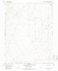
1969 Map of Moorman Spring NW
USGS Topo · Published 1971About this map
White River Valley dominates the eastern half of this 1969 topographic study, where the arid basin floor meets the rising slopes of The Cove to the west. This landscape is defined by its scarce water resources, evidenced by a network of remote watering points essential for ranching and survival in the Great Basin. Named infrastructure like Carter Well, Gubler Well, and Sorensen Well indicate the scattered presence of early homesteading or grazing operations along the White Pine and Nye County line. The map captures the region's transition from the open valley floor to the high, complex topography of the western hills, with Government Well and Cabin Well marking specific points of human activity in an otherwise sparsely settled territory.
Find a feature on this map
13 named features on this map. Tap any name to fly to it.
Don’t see what you’re looking for? This feature index may not catch every label — zoom into the map to look around manually.
Map Details
Editions of this 1969 Moorman Spring NW Map
2 editions found
Other maps of this area

1956 · Lund
USGS Topo · 1:250,000

1957 · Currant Mtn
USGS Topo · 1:62,500

1960 · Lund
USGS Topo · 1:250,000

1964 · Currant
USGS Topo · 1:62,500

1964 · Currant Mtn
USGS Topo · 1:62,500

1969 · Moorman Spring SE
USGS Topo · 1:24,000

1969 · Moorman Spring
USGS Topo · 1:24,000

1969 · Moorman Spring NE
USGS Topo · 1:24,000
1978 · Lund
USGS Topo · 1:24,000
1978 · Douglas
USGS Topo · 1:24,000