
1969 Map of Moorman Spring
USGS Topo · Published 1971About this map
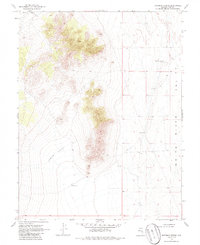
Moorman Spring (Hot) stands as a primary water source in this arid stretch of White River Valley, located within Nye County. The landscape is defined by the significant topographic variations between the floor of the valley and the elevated formations of The Cove and Lower Cove. Human presence in this high-desert environment is tied closely to scattered water points and precarious transit, represented by Riordans Well and Opu Well along the base of the mountains. A single Jeep Trail navigates the rugged transition between the valley floor and the higher basins, illustrating the era's reliance on specialized vehicles to access the Nevada interior for ranching or prospecting. The 1969 field check by the Geological Survey captures a moment before modern infrastructure altered these remote corridors.
Find a feature on this map
8 named features on this map. Tap any name to fly to it.
Don’t see what you’re looking for? This feature index may not catch every label — zoom into the map to look around manually.
Map Details
Editions of this 1969 Moorman Spring Map
2 editions found
Other maps of this area

1956 · Lund
USGS Topo · 1:250,000

1960 · Lund
USGS Topo · 1:250,000

1964 · Currant
USGS Topo · 1:62,500

1964 · Forest Home
USGS Topo · 1:62,500

1969 · Sunnyside
USGS Topo · 1:24,000

1969 · Moorman Spring SE
USGS Topo · 1:24,000

1969 · Sunnyside NW
USGS Topo · 1:24,000

1969 · Moorman Spring NW
USGS Topo · 1:24,000

1969 · Moorman Spring NE
USGS Topo · 1:24,000

1980 · Duckwater
USGS Topo · 1:100,000