
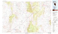
1980 Map of Duckwater
USGS Topo · Published 1981About this map
The Duckwater Indian Reservation and the remote settlement of Duckwater anchor this interior Nevada landscape at the beginning of the 1980s. The terrain is defined by a series of parallel north-south mountain corridors, including the Pancake Range, White Pine Range, and the Grant Range, which separate the expansive Railroad Valley from the White River Valley. This period shows the region's reliance on isolated landing fields, such as the Duckwater Landing Strip and Currant Landing Strip, alongside established routes like Route 318 connecting Preston and Lund. A notable geological curiosity, the Meteorite Crater, sits in the hills west of the reservation. The map also records the Gold Point Mine and the conservation boundaries of the Railroad Valley Wildlife Management Area, reflecting the dual use of the land for mineral extraction and wildlife preservation.
Find a feature on this map
34 named features on this map. Tap any name to fly to it.
Don’t see what you’re looking for? This feature index may not catch every label — zoom into the map to look around manually.
Map Details
Editions of this 1980 Duckwater Map
2 editions found
Other maps of this area

1926 · Roberts Mountains
USGS Topo · 1:250,000

1929 · Roberts Mountains
USGS Topo · 1:250,000

1949 · Treasure Hill
USGS Topo · 1:62,500

1950 · Treasure Hill
USGS Topo · 1:62,500

1951 · Green Springs
USGS Topo · 1:62,500

1952 · Ely
USGS Topo · 1:125,000

1955 · Millett
USGS Topo · 1:250,000

1956 · Cockalorum Wash
USGS Topo · 1:62,500

1956 · Lund
USGS Topo · 1:250,000

1956 · Ely
USGS Topo · 1:250,000