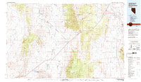
1980 Map of Duckwater
USGS Topo · Published 1981About this map
Duckwater Indian Reservation sits at the heart of this high-desert basin, where the Duckwater Valley and Railroad Valley converge. During the early 1980s, this landscape was defined by its scattered springs and isolated outposts like Lockes and Beaty. The map details a complex network of hydrological features essential for life in the Great Basin, from the Flowing Well and Blue Eagle Springs to the Blackjack Reservoir.
Find a feature on this map
96 named features on this map. Tap any name to fly to it.
Don’t see what you’re looking for? This feature index may not catch every label — zoom into the map to look around manually.
Map Details
Editions of this 1980 Duckwater Map
2 editions found

Other maps of this area

1926 · Roberts Mountains
USGS Topo · 1:250,000

1929 · Roberts Mountains
USGS Topo · 1:250,000

1949 · Treasure Hill
USGS Topo · 1:62,500

1950 · Treasure Hill
USGS Topo · 1:62,500

1951 · Green Springs
USGS Topo · 1:62,500

1952 · Ely
USGS Topo · 1:125,000

1955 · Millett
USGS Topo · 1:250,000

1956 · Cockalorum Wash
USGS Topo · 1:62,500

1956 · Lund
USGS Topo · 1:250,000

1956 · Ely
USGS Topo · 1:250,000