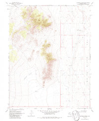
1969 Map of Moorman Spring
USGS Topo · Published 1986About this map
Moorman Spring (Hot) serves as a primary focal point in this high-desert landscape of Nye County, where geothermal activity and isolated water sources dictated the patterns of movement and survival. The map reveals the stark topography of the region, anchored by the wide expanse of the White River Valley to the east and the protective recesses of The Cove and Lower Cove to the west. Evidence of remote ranching and grazing infrastructure appears through isolated landmarks like Riordans Well and OPU Well, while a lonely Jeep Trail provides the only recorded passage through the steep terrain between the valleys. The survey, based on 1964 aerial photography and 1969 field checks, captures the area during a period of minimal development, preserving the exact locations of these vital desert water points before modern changes.
Find a feature on this map
9 named features on this map. Tap any name to fly to it.
Don’t see what you’re looking for? This feature index may not catch every label — zoom into the map to look around manually.
Map Details
Editions of this 1969 Moorman Spring Map
2 editions found
Other maps of this area

1956 · Lund
USGS Topo · 1:250,000

1960 · Lund
USGS Topo · 1:250,000

1964 · Currant
USGS Topo · 1:62,500

1964 · Forest Home
USGS Topo · 1:62,500

1969 · Sunnyside
USGS Topo · 1:24,000

1969 · Moorman Spring SE
USGS Topo · 1:24,000

1969 · Sunnyside NW
USGS Topo · 1:24,000

1969 · Moorman Spring NW
USGS Topo · 1:24,000

1969 · Moorman Spring
USGS Topo · 1:24,000

1969 · Moorman Spring NE
USGS Topo · 1:24,000