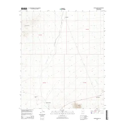
2014 Map of Haivana Nakya
USGS Topo · Published 2014About this map
Haivana Nakya and Schuchk anchor this desert landscape within the Baboquivari Valley, where drainage patterns define the settlement and transport corridors. The southern portion of the map is dominated by the transit route of Az-86, passing through the community of San Vicente at the foot of the Quinlan Mountains. To the north, the Comobabi Mountains rise above the valley floor, while dry desert watercourses like Anegan Wash, San Vicente Wash, and Pavo Kug Wash illustrate the complex hydrology of the Sonoran region. This mapping provides a detailed look at the infrastructure within the Schuk Toak District, including Bureau of Indian Affairs routes like Bia-35 and Bia-30, which serve as vital links between these isolated desert communities.
Find a feature on this map
16 named features on this map. Tap any name to fly to it.
Don’t see what you’re looking for? This feature index may not catch every label — zoom into the map to look around manually.
Map Details
Editions of this 2014 Haivana Nakya Map
This is the sole edition of this map. No revisions or reprints were ever made.
Other maps of this area

1934 · Silver Bell
USGS Topo · 1:125,000

1937 · Comobabi
USGS Topo · 1:48,000

1938 · San Vicente
USGS Topo · 1:62,500

1941 · San Vicente
USGS Topo · 1:62,500

1941 · Baboquivari Peak
USGS Topo · 1:62,500

1941 · Sells
USGS Topo · 1:62,500

1942 · San Vicente
USGS Topo · 1:62,500

1942 · Comobabi
USGS Topo · 1:62,500

1943 · Sells
USGS Topo · 1:62,500

1943 · Fresnal
USGS Topo · 1:125,000
Featured Places
- Schuk Toak District, AZ
- Haivana Nakya, Schuk Toak District
- San Vicente, Schuk Toak District
- Schuchk, Schuk Toak District
- Pima County, AZ