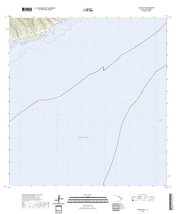
2024 Map of Halawa OE S
USGS Topo · Published 2024About this map
Ancient shoreline engineering dominates this section of the Maui coast, where traditional aquaculture sites like Ni'aupala Fishpond, Kūpeke Fishpond, and Kihaloko Fishpond define the boundary between land and sea. These coastal features, along with small maritime entries at Puko'o Harbor and Honomuni Harbor, suggest a landscape historically tied to local subsistence and the management of water resources. The terrain inland rises sharply, carved by numerous drainage features including Mapulehu Stream and a series of steep ravines such as Pu'ulua Gulch and Puna'ula Gulch. Stretching east across the deep waters of the Pacific Ocean, the map highlights the proximity of the Pailolo Channel, the vital waterway separating Maui from its neighboring islands. The dense concentration of named gulches and fishponds illustrates a deeply etched relationship between the volcanic island topography and the inhabitants' coastal livelihood.
Find a feature on this map
15 named features on this map. Tap any name to fly to it.
Don’t see what you’re looking for? This feature index may not catch every label — zoom into the map to look around manually.
Map Details
Editions of this 2024 Halawa OE S Map
This is the sole edition of this map. No revisions or reprints were ever made.
Other maps of this area

1923 · Island of Lanai
USGS Topo · 1:31,680

1925 · Island of Lanai
USGS Topo · 1:62,500

1952 · Halawa
USGS Topo · 1:24,000

1952 · Kamalo
USGS Topo · 1:24,000

1954 · Maui
USGS Topo · 1:250,000

1956 · Lahaina
USGS Topo · 1:24,000

1956 · Honolua
USGS Topo · 1:24,000

1966 · Maui
USGS Topo · 1:250,000

1968 · Halawa
USGS Topo · 1:24,000
1968 · Kamalo
USGS Topo · 1:24,000