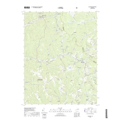
2019 Map of Haldeman
USGS Topo · Published 2019About this map
The Daniel Boone National Forest covers a significant portion of this Rowan County landscape, where the topography is defined by narrow hollows and numerous creek branches. Small, named settlements such as Haldeman, Elliottville, and Hays Crossing serve as hubs for a dense network of family-named cemeteries and rural roads. The area's complex drainage is evidenced by Triplett Creek and Christy Creek, which are fed by dozens of tributaries like Bearskin Hollow and Parker Hollow. Genealogists will find a wealth of data in the specific naming of burial sites, including the Abbott-Sturgill Cem, W B Hall Cem, and Sparks Cemetery One. This modern survey illustrates the persistent rural character of eastern Kentucky, where geographic identity is still deeply tied to family lineages and small creek valleys like Mocabee Creek.
Find a feature on this map
173 named features on this map. Tap any name to fly to it.
Don’t see what you’re looking for? This feature index may not catch every label — zoom into the map to look around manually.
Map Details
Editions of this 2019 Haldeman Map
This is the sole edition of this map. No revisions or reprints were ever made.
Other maps of this area

1929 · Morehead
USGS Topo · 1:48,000

1935 · Morehead
USGS Topo · 1:62,500

1950 · Olive Hill
USGS Topo · 1:24,000

1950 · Ault
USGS Topo · 1:24,000

1950 · Sandy Hook
USGS Topo · 1:24,000

1951 · Soldier
USGS Topo · 1:24,000

1951 · Cranston
USGS Topo · 1:24,000

1953 · Haldeman
USGS Topo · 1:24,000

1953 · Bangor
USGS Topo · 1:24,000
1953 · Wrigley
USGS Topo · 1:24,000