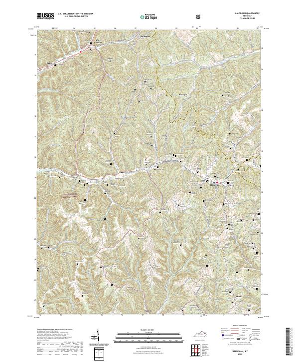
2022 Map of Haldeman
USGS Topo · Published 2022About this map
Haldeman and Elliottville anchor this 2022 survey of the Eastern Kentucky hills where Rowan Co meets Carter Co and Elliott Co. The landscape is defined by a dense network of family-named cemeteries and hollows, reflecting a long history of kin-based settlement across Bearskin Hollow, Richards Hollow, and Parker Hollow. Many of these sites, such as the White Family Cem and Goodan Fultz Cem, are located along the winding valley of Christy Creek, while others like the Robinson Cem and Earn Purnell Cem occupy the ridges further east.
Find a feature on this map
141 named features on this map. Tap any name to fly to it.
Don’t see what you’re looking for? This feature index may not catch every label — zoom into the map to look around manually.
Map Details
Editions of this 2022 Haldeman Map
This is the sole edition of this map. No revisions or reprints were ever made.
Other maps of this area

1929 · Morehead
USGS Topo · 1:48,000

1935 · Morehead
USGS Topo · 1:62,500

1950 · Olive Hill
USGS Topo · 1:24,000

1950 · Ault
USGS Topo · 1:24,000

1950 · Sandy Hook
USGS Topo · 1:24,000

1951 · Soldier
USGS Topo · 1:24,000

1951 · Cranston
USGS Topo · 1:24,000

1953 · Haldeman
USGS Topo · 1:24,000

1953 · Bangor
USGS Topo · 1:24,000
1953 · Wrigley
USGS Topo · 1:24,000