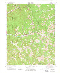
1977 Map of Haldeman
USGS Topo · Published 1977About this map
The Daniel Boone National Forest dominates much of this landscape, where the ridges of eastern Kentucky are cut by an intricate network of waterways like Christy Creek and Triplett Creek. In the northern section, the Chesapeake and Ohio railroad corridor tracks alongside settlements such as Hays Crossing and Haldeman. Further south, the map reveals an older transportation history with a noted Old Railroad Grade winding through the hills near Brinegar. Local social centers and family histories are anchored by rural institutions like Oak Grove Ch, Slabcamp Ch, and several hillside cemeteries including Christian Cem and Williams Cem. Small-scale industrial activity is evidenced by scattered mines and a quarry, indicating the extractive economy that shaped these communities between Elliottville and the Rowan and Carter County line.
Find a feature on this map
55 named features on this map. Tap any name to fly to it.
Don’t see what you’re looking for? This feature index may not catch every label — zoom into the map to look around manually.
Map Details
Editions of this 1977 Haldeman Map
This is the sole edition of this map. No revisions or reprints were ever made.
Other maps of this area

1929 · Morehead
USGS Topo · 1:48,000

1935 · Morehead
USGS Topo · 1:62,500

1950 · Olive Hill
USGS Topo · 1:24,000

1950 · Ault
USGS Topo · 1:24,000

1950 · Sandy Hook
USGS Topo · 1:24,000

1951 · Soldier
USGS Topo · 1:24,000

1951 · Cranston
USGS Topo · 1:24,000

1953 · Haldeman
USGS Topo · 1:24,000

1953 · Bangor
USGS Topo · 1:24,000
1953 · Wrigley
USGS Topo · 1:24,000