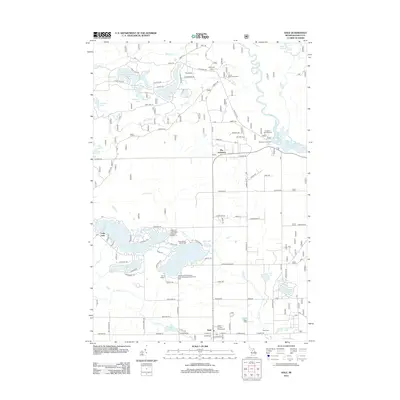
2012 Map of Hale
USGS Topo · Published 2012About this map
Hale serves as the primary hub for this portion of Iosco County, situated south of a dense network of glacial lakes and the winding Au Sable River. The settlement pattern here is defined by seasonal and recreational landscapes, with large clusters of vacation homes and cottages lining the shores of Long Lake, Loon Lake, and Jose Lake. These water bodies are central to the local economy and culture, evidenced by the numerous youth retreats and public spaces such as Camp Mahn-Go-Tah-See, Camp Maqua, and the Hale Plainfield Township park Campground and Picnic Area.
Find a feature on this map
89 named features on this map. Tap any name to fly to it.
Don’t see what you’re looking for? This feature index may not catch every label — zoom into the map to look around manually.
Map Details
Editions of this 2012 Hale Map
This is the sole edition of this map. No revisions or reprints were ever made.
Other maps of this area

1954 · Tawas City
USGS Topo · 1:250,000

1958 · Tawas City
USGS Topo · 1:250,000

1959 · Tawas City
USGS Topo · 1:62,500

1959 · Glennie
USGS Topo · 1:62,500

1968 · Hale
USGS Topo · 1:24,000

1968 · Sage Lake
USGS Topo · 1:24,000

1968 · South Branch
USGS Topo · 1:24,000

1968 · Hale SE
USGS Topo · 1:24,000

1972 · Goodar
USGS Topo · 1:24,000

1972 · Alcona Dam Pond
USGS Topo · 1:24,000