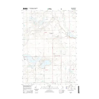
2014 Map of Hale
USGS Topo · Published 2014About this map
Huron National Forest covers much of this landscape in Plainfield Township, where the Au Sable River and South Br River navigate through a terrain dominated by glacial lakes and wetlands. The community of Hale serves as a local hub, situated near Hale Lake and Hale Cr, with Hale Cem located to the east. Further north, the distinctively named settlement of The Jackpines reflects the local timber ecology, while Long Lake and Loon Lake define the central water systems. This 2014 survey documents a region where recreation and forestry are primary, visible in the network of forest roads like Ponderosa Rd and Shoreward Trl. Genealogists may find value in the location of Thompson Cem near Big Gle Rd, while historians can trace the water levels of Loud Dam Pond and numerous smaller bodies such as Welcome Lake and Alice Lake.
Find a feature on this map
67 named features on this map. Tap any name to fly to it.
Don’t see what you’re looking for? This feature index may not catch every label — zoom into the map to look around manually.
Map Details
Editions of this 2014 Hale Map
This is the sole edition of this map. No revisions or reprints were ever made.
Other maps of this area

1954 · Tawas City
USGS Topo · 1:250,000

1958 · Tawas City
USGS Topo · 1:250,000

1959 · Tawas City
USGS Topo · 1:62,500

1959 · Glennie
USGS Topo · 1:62,500

1968 · Hale
USGS Topo · 1:24,000

1968 · Sage Lake
USGS Topo · 1:24,000

1968 · South Branch
USGS Topo · 1:24,000

1968 · Hale SE
USGS Topo · 1:24,000

1972 · Goodar
USGS Topo · 1:24,000

1972 · Alcona Dam Pond
USGS Topo · 1:24,000