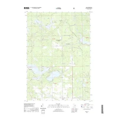
2019 Map of Hale
USGS Topo · Published 2019About this map
The settlement of Hale and the surrounding woodlands of the Huron National Forest dominate this landscape in the northern Lower Peninsula. This area is defined by a dense concentration of glacial lakes and recreational networks, including the MI Shore to Shore Horsehike and several Huron ORV paths. The village of Hale serves as a central hub, with local landmarks like Hale Cem and the waters of Hale Lake providing a focal point for researchers interested in the town's footprint.
Find a feature on this map
71 named features on this map. Tap any name to fly to it.
Don’t see what you’re looking for? This feature index may not catch every label — zoom into the map to look around manually.
Map Details
Editions of this 2019 Hale Map
This is the sole edition of this map. No revisions or reprints were ever made.
Other maps of this area

1954 · Tawas City
USGS Topo · 1:250,000

1958 · Tawas City
USGS Topo · 1:250,000

1959 · Tawas City
USGS Topo · 1:62,500

1959 · Glennie
USGS Topo · 1:62,500

1968 · Hale
USGS Topo · 1:24,000

1968 · Sage Lake
USGS Topo · 1:24,000

1968 · South Branch
USGS Topo · 1:24,000

1968 · Hale SE
USGS Topo · 1:24,000

1972 · Goodar
USGS Topo · 1:24,000

1972 · Alcona Dam Pond
USGS Topo · 1:24,000