1947 Map of Halifax
USGS Topo · Published 1963About this map
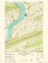
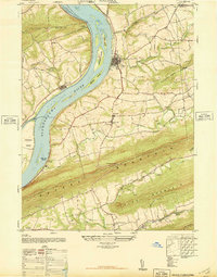
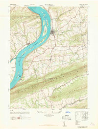
The Susquehanna River dominates this mid-century landscape, carving a wide path through the ridge-and-valley terrain of Dauphin County. Large mid-river landforms like Clempson Island and Haldeman Island sit across from the settlement of Halifax, where the local road network converges. To the south, the massive parallel ridges of Peters Mountain, Third Mountain, and Second Mountain create a formidable geographic barrier, with the Peters Mountain Airway Beacon perched atop the highest crest to guide mid-century aviators.
Find a feature on this map
41 named features on this map. Tap any name to fly to it.
Don’t see what you’re looking for? This feature index may not catch every label — zoom into the map to look around manually.
Map Details
Editions of this 1947 Halifax Map
3 editions found
Other maps of this area

1892 · Harrisburg
USGS Topo · 1:62,500

1893 · Millersburg
USGS Topo · 1:62,500

1899 · Harrisburg
USGS Topo · 1:62,500

1907 · New Bloomfield
USGS Topo · 1:62,500

1907 · Millerstown
USGS Topo · 1:62,500

1924 · Harrisburg
USGS Topo · 1:62,500

1943 · Millerstown
USGS Topo · 1:62,500

1943 · Millersburg
USGS Topo · 1:62,500

1943 · Harrisburg
USGS Topo · 1:62,500

1943 · New Bloomfield
USGS Topo · 1:62,500