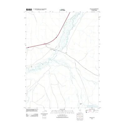
2012 Map of Halleck
USGS Topo · Published 2012About this map
The settlement of Halleck serves as the focal point of this high-desert landscape, situated where the Humboldt River and its various tributaries converge. This 2012 survey illustrates the infrastructure of the northeastern Great Basin, centered on the Halleck Post Office and the modern Halleck Interchange. The map captures a complex network of waterways, including Lamoille Creek, Secret Creek, and John Day Creek, which feed into the valley bottom. Ranching life is evident through named properties like Glaser Ranch and El Rancho, alongside the southward expanse of the Lamoille Valley. The terrain is characterized by the branching paths of the South Branch Lamoille Creek and Soldier Creek, terminating near the eastern edge of the quadrangle. Local landmarks such as Lake Phyllis and rural thoroughfares like Sage Ln and Mcintyre Rd provide specific reference points for the contemporary geography of Elko County.
Find a feature on this map
17 named features on this map. Tap any name to fly to it.
Don’t see what you’re looking for? This feature index may not catch every label — zoom into the map to look around manually.
Map Details
Editions of this 2012 Halleck Map
This is the sole edition of this map. No revisions or reprints were ever made.
Other maps of this area

1935 · Halleck
USGS Topo · 1:125,000

1955 · Wells
USGS Topo · 1:250,000

1955 · Elko
USGS Topo · 1:250,000

1958 · Wells
USGS Topo · 1:250,000

1958 · Elko
USGS Topo · 1:250,000

1961 · Wells
USGS Topo · 1:250,000

1962 · Elko
USGS Topo · 1:250,000

1962 · Boyd Reservoir
USGS Topo · 1:24,000

1962 · Ryndon
USGS Topo · 1:24,000

1965 · Elko
USGS Topo · 1:250,000