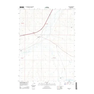
2014 Map of Halleck
USGS Topo · Published 2014About this map
The Humboldt River carves through the heart of this northeastern Nevada landscape, where the settlements of Halleck and Elburz serve as focal points for the surrounding ranching and transit corridor. Located in the Lamoille Valley, the terrain transitions from the river flats to more defined upland features like Dennis Flats. The hydrology of the region is particularly dense, with numerous tributaries such as Lamoille Cr, John Day Cr, and Secret Cr flowing toward the main river channel. Local transit is defined by rural routes like McIntyre Rd and Sage Ln, which navigate the valley floor and provide access to remote water bodies like Lake Phyllis. This 2014 survey documents the enduring spatial relationship between these small settlements and the complex network of mountain-fed creeks that sustain the valley's agricultural character.
Find a feature on this map
18 named features on this map. Tap any name to fly to it.
Don’t see what you’re looking for? This feature index may not catch every label — zoom into the map to look around manually.
Map Details
Editions of this 2014 Halleck Map
This is the sole edition of this map. No revisions or reprints were ever made.
Other maps of this area

1935 · Halleck
USGS Topo · 1:125,000

1955 · Wells
USGS Topo · 1:250,000

1955 · Elko
USGS Topo · 1:250,000

1958 · Wells
USGS Topo · 1:250,000

1958 · Elko
USGS Topo · 1:250,000

1961 · Wells
USGS Topo · 1:250,000

1962 · Elko
USGS Topo · 1:250,000

1962 · Boyd Reservoir
USGS Topo · 1:24,000

1962 · Ryndon
USGS Topo · 1:24,000

1965 · Elko
USGS Topo · 1:250,000