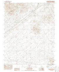
1983 Map of Halloran Springs
USGS Topo · Published 1985About this map
Halloran Springs serves as a focal point in this high desert landscape, accompanied by a dedicated Trailer Park and a Landing Strip that reflect the mid-century infrastructure of the Mojave. The terrain is marked by essential utilities, including an Underground Gas Pipeline and an Underground Pipeline traversing the arid expanse. Natural drainage is defined by Bull Spring Wash and various other unnamed washes that cut through the topography. Industrial and transport activity is evident through the presence of Gravel Pits, a Borrow Pit, and a remote Prospect, suggesting localized mineral exploration or road maintenance. Modern transit needs are represented by Rest Areas along the highway corridor, while Kelbaker Road provides a primary route through the desert floor. The map illustrates the specialized development required to sustain small settlements and travelers in a desert environment before contemporary expansion.
Find a feature on this map
16 named features on this map. Tap any name to fly to it.
Don’t see what you’re looking for? This feature index may not catch every label — zoom into the map to look around manually.
Map Details
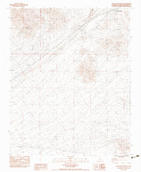
Editions of this 1983 Halloran Springs Map
2 editions found
Other maps of this area

1910 · Ivanpah
USGS Topo · 1:250,000

1912 · Ivanpah
USGS Topo · 1:250,000

1933 · Avawatz Mountains
USGS Topo · 1:250,000

1942 · Ivanpah
USGS Topo · 1:250,000

1947 · Trona
USGS Topo · 1:250,000

1947 · Kingman
USGS Topo · 1:250,000

1948 · Kingman
USGS Topo · 1:250,000

1948 · Trona
USGS Topo · 1:250,000

1953 · Trona
USGS Topo · 1:250,000

1954 · Kingman
USGS Topo · 1:250,000