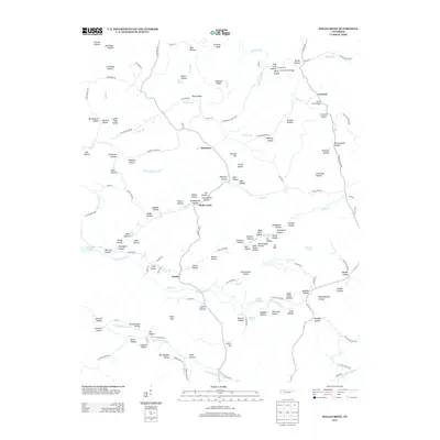
2013 Map of Halls Creek
USGS Topo · Published 2013About this map
Halls Creek and the surrounding hollows of Humphreys County are defined by a complex network of streams and ridges documented in this 2013 survey. The landscape is characterized by a high density of named drainage features, including Big Richland Cr and South Fork Turkey Cr, which flow through deeply carved valleys such as Cullum Hollow and Madden Hollow. Small rural centers like Belleview and Trinity anchor the road system, while the presence of Schoolhouse Hollow and Churchhouse Hollow suggests the historical locations of essential community buildings. Along the western edge, the map captures the transition to the waters of Kentucky Lake, where McCloud Hollow meets the submerged terrain of the Tennessee River valley. This edition provides a clear record of local family names and landmarks, from the crossing at Grice Ford Bridge to the high ground of Resin Ridge and Chestnut Ridge.
Find a feature on this map
146 named features on this map. Tap any name to fly to it.
Don’t see what you’re looking for? This feature index may not catch every label — zoom into the map to look around manually.
Map Details
Editions of this 2013 Halls Creek Map
This is the sole edition of this map. No revisions or reprints were ever made.
Other maps of this area

1931 · Erin
USGS Topo · 1:62,500

1936 · Gorman
USGS Topo · 1:24,000

1936 · Tantrough Hollow
USGS Topo · 1:24,000

1936 · McKinnon
USGS Topo · 1:24,000

1936 · Woolworth
USGS Topo · 1:24,000

1936 · Stewart
USGS Topo · 1:24,000

1936 · Halls Creek
USGS Topo · 1:24,000

1936 · Johnsonville
USGS Topo · 1:24,000

1936 · Harmon Creek
USGS Topo · 1:24,000

1936 · Waverly
USGS Topo · 1:24,000