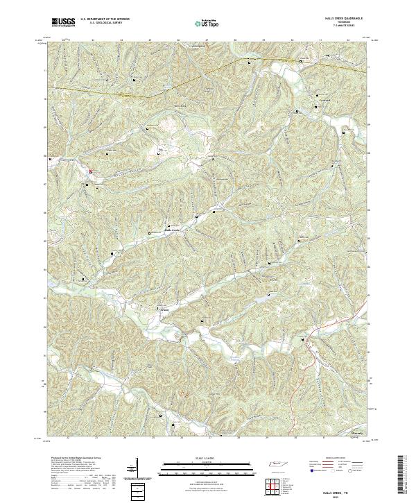
2022 Map of Halls Creek
USGS Topo · Published 2022About this map
Deeply dissected terrain along the border of Houston and Humphreys counties defines this landscape, where narrow valleys and hollows dictate the pattern of human settlement. The rural communities of Halls Creek and Trinity serve as local anchors, connected by a network of winding roads like Halls Creek Rd and Clydeton Rd. The map is particularly dense with small family and community burial grounds, including Concord Cem, Madden Cem, and the Collier Family Cem, providing a detailed spatial record for genealogical research in this portion of Middle Tennessee.
Find a feature on this map
159 named features on this map. Tap any name to fly to it.
Don’t see what you’re looking for? This feature index may not catch every label — zoom into the map to look around manually.
Map Details
Editions of this 2022 Halls Creek Map
This is the sole edition of this map. No revisions or reprints were ever made.
Other maps of this area

1931 · Erin
USGS Topo · 1:62,500

1936 · Gorman
USGS Topo · 1:24,000

1936 · Tantrough Hollow
USGS Topo · 1:24,000

1936 · McKinnon
USGS Topo · 1:24,000

1936 · Woolworth
USGS Topo · 1:24,000

1936 · Stewart
USGS Topo · 1:24,000

1936 · Halls Creek
USGS Topo · 1:24,000

1936 · Johnsonville
USGS Topo · 1:24,000

1936 · Harmon Creek
USGS Topo · 1:24,000

1936 · Waverly
USGS Topo · 1:24,000