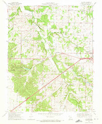
1969 Map of Halltown
USGS Topo · Published 1971About this map
Turnback Creek and its many tributaries, including Spencer Creek and Billies Creek, carve through the eastern reaches of the Ozark Plateau in this late 1960s study of Lawrence County. The landscape is a mix of agricultural clearings and wooded hollows like Carmen Hollow and Johnson Hollow, where spring-fed features such as Cove Spring and the curiously named Devils Wash Pan suggest a complex karst topography. Small communities serve as anchors for the rural population, with Halltown and Paris Springs situated along the primary east-west corridor.
Find a feature on this map
35 named features on this map. Tap any name to fly to it.
Don’t see what you’re looking for? This feature index may not catch every label — zoom into the map to look around manually.
Map Details
Editions of this 1969 Halltown Map
This is the sole edition of this map. No revisions or reprints were ever made.
Other maps of this area

1886 · Greenfield
USGS Topo · 1:125,000

1888 · Greenfield
USGS Topo · 1:125,000

1919 · Halltown
USGS Topo · 1:62,500

1921 · Stotts City
USGS Topo · 1:62,500

1954 · Springfield
USGS Topo · 1:250,000

1956 · Ash Grove
USGS Topo · 1:24,000
1956 · South Greenfield
USGS Topo · 1:24,000
1956 · Everton
USGS Topo · 1:24,000

1958 · Springfield
USGS Topo · 1:250,000

1959 · Springfield
USGS Topo · 1:250,000