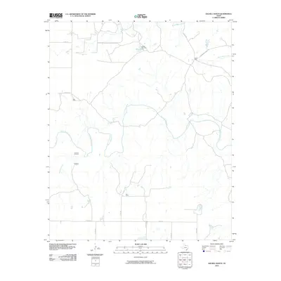
2010 Map of Halsell Ranch
USGS Topo · Published 2010About this map
The North Wichita River meanders across this Knox County landscape, defining a region where water management and ranching operations are central to the terrain. Established holdings such as Halsell Ranch and Ellis Ranch anchor the local geography, connected by a network of rural routes including Halsell Rd and Montgomery Ranch Rd. The importance of water security in this part of Texas is evident through features like Halsell Lake Dam, which creates Halsell Lake, and the presence of named infrastructure like the West End Windmill and Deadman Windmill. North of the river, Middle Beaver Creek and South Beaver Creek drain the higher ground. The map reflects a modern rural economy where land use is dictated by the courses of Deadman Creek and the main river, supporting isolated residential sites like West Camp amidst the expansive ranch lands.
Find a feature on this map
21 named features on this map. Tap any name to fly to it.
Don’t see what you’re looking for? This feature index may not catch every label — zoom into the map to look around manually.
Map Details
Editions of this 2010 Halsell Ranch Map
This is the sole edition of this map. No revisions or reprints were ever made.
Other maps of this area

1954 · Wichita Falls
USGS Topo · 1:250,000

1958 · Wichita Falls
USGS Topo · 1:250,000

1966 · Truscott North
USGS Topo · 1:24,000

1966 · Colwell Creek
USGS Topo · 1:24,000

1966 · Truscott South
USGS Topo · 1:24,000

1966 · Halsell Ranch
USGS Topo · 1:24,000

1966 · Gilliland
USGS Topo · 1:24,000

1966 · Crowell
USGS Topo · 1:24,000

1966 · Vera
USGS Topo · 1:24,000

1966 · Thalia
USGS Topo · 1:24,000