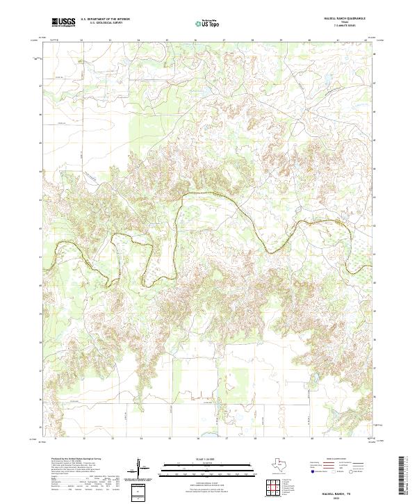
2022 Map of Halsell Ranch
USGS Topo · Published 2022About this map
The North Wichita River carves a winding path through this North Texas ranching landscape, serving as a natural boundary between Foard and Knox counties. This recent survey highlights the remote character of the region, dominated by extensive rangeland and drainage systems. The presence of Halsell Lake and several named creeks, including Middle Beaver Cr and Deadman Cr, indicates the vital importance of water management in this arid environment. The road network is largely composed of local routes like Halsell Ranch Rd and Montgomery Ranch Rd, reflecting a landscape dedicated to large-scale agriculture and private ranching interests. These named roads often follow the natural contours of the land, connecting scattered homesteads and water sources across the rolling plains of the Rolling Plains region.
Find a feature on this map
20 named features on this map. Tap any name to fly to it.
Don’t see what you’re looking for? This feature index may not catch every label — zoom into the map to look around manually.
Map Details
Editions of this 2022 Halsell Ranch Map
This is the sole edition of this map. No revisions or reprints were ever made.
Other maps of this area

1954 · Wichita Falls
USGS Topo · 1:250,000

1958 · Wichita Falls
USGS Topo · 1:250,000

1966 · Truscott North
USGS Topo · 1:24,000

1966 · Colwell Creek
USGS Topo · 1:24,000

1966 · Truscott South
USGS Topo · 1:24,000

1966 · Halsell Ranch
USGS Topo · 1:24,000

1966 · Gilliland
USGS Topo · 1:24,000

1966 · Crowell
USGS Topo · 1:24,000

1966 · Vera
USGS Topo · 1:24,000

1966 · Thalia
USGS Topo · 1:24,000