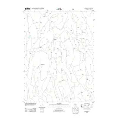
2012 Map of Hambone
USGS Topo · Published 2012About this map
Hambone and Slagger anchor this high-altitude landscape in Siskiyou County, where forestry and seasonal access define the land use. The terrain is characterized by prominent volcanic features including Hambone Butte and the broad elevation of Bear Mountain. A complex network of timber and access roads, such as Medicine Lake Rd and Old Camp Two Rd, suggests a landscape shaped by active forest management and recreation. Water features are sparse but significant, with White Deer Lake and Bear Lake providing essential landmarks for navigation through the dense woodlands. The inclusion of numerous forest routes like Forest Rte 24 and Forest Rte 40N05 illustrates the intricate system of trails and service roads that crisscross the area between Hunters Hill and Whitlow Ridge.
Find a feature on this map
17 named features on this map. Tap any name to fly to it.
Don’t see what you’re looking for? This feature index may not catch every label — zoom into the map to look around manually.
Map Details
Editions of this 2012 Hambone Map
This is the sole edition of this map. No revisions or reprints were ever made.
Other maps of this area

1886 · Modoc Lava Bed
USGS Topo · 1:250,000

1892 · Modoc Lava-Bed
USGS Topo · 1:250,000

1932 · Bartle
USGS Topo · 1:96,000

1939 · Bartle
USGS Topo · 1:125,000

1954 · Alturas
USGS Topo · 1:250,000

1958 · Alturas
USGS Topo · 1:250,000

1961 · Hambone
USGS Topo · 1:62,500

1961 · Pondosa
USGS Topo · 1:62,500
1961 · Big Bend
USGS Topo · 1:62,500

1961 · Bartle
USGS Topo · 1:62,500