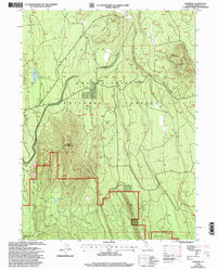
1998 Map of Hambone
USGS Topo · Published 2003About this map
Shasta-Trinity National Forest defines this high-elevation landscape in eastern Siskiyou County, dominated by volcanic peaks and essential water infrastructure for forest management. The small settlement at Hambone and the nearby Hambone Pump Station serve as central nodes for the network of timber and access routes, including the prominent Powder Hill Road. Topographic features like Hambone Butte, Bear Mountain, and Hunters Hill rise above a terrain marked by isolated water sources such as White Deer Lake and Bear Lake.
Find a feature on this map
18 named features on this map. Tap any name to fly to it.
Don’t see what you’re looking for? This feature index may not catch every label — zoom into the map to look around manually.
Map Details
Editions of this 1998 Hambone Map
This is the sole edition of this map. No revisions or reprints were ever made.
Other maps of this area

1886 · Modoc Lava Bed
USGS Topo · 1:250,000

1892 · Modoc Lava-Bed
USGS Topo · 1:250,000

1932 · Bartle
USGS Topo · 1:96,000

1939 · Bartle
USGS Topo · 1:125,000

1954 · Alturas
USGS Topo · 1:250,000

1958 · Alturas
USGS Topo · 1:250,000

1961 · Hambone
USGS Topo · 1:62,500

1961 · Pondosa
USGS Topo · 1:62,500
1961 · Big Bend
USGS Topo · 1:62,500

1961 · Bartle
USGS Topo · 1:62,500