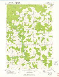
1978 Map of Hamburg
USGS Topo · Published 1979About this map
The confluence of the Big Rib River and the Rib River anchors this 1970s landscape in Marathon County, where the settlement of Hamburg sits at the crossing of several major local thoroughfares. The map reveals a community structured around its spiritual and civic institutions, featuring St Pauls Ch and Salem Ch, along with the St Pauls Cem and Lueck Cem which serve as vital touchstones for family historians.
Find a feature on this map
26 named features on this map. Tap any name to fly to it.
Don’t see what you’re looking for? This feature index may not catch every label — zoom into the map to look around manually.
Map Details
Editions of this 1978 Hamburg Map
This is the sole edition of this map. No revisions or reprints were ever made.
Other maps of this area

1902 · Marathon
USGS Topo · 1:125,000

1951 · Athens
USGS Topo · 1:48,000

1951 · Hamburg
USGS Topo · 1:48,000

1953 · Marathon
USGS Topo · 1:48,000

1953 · Stratford
USGS Topo · 1:48,000

1953 · Eau Claire
USGS Topo · 1:250,000

1953 · Rice Lake
USGS Topo · 1:250,000

1954 · Iron Mountain
USGS Topo · 1:250,000

1955 · Green Bay
USGS Topo · 1:250,000

1958 · Eau Claire
USGS Topo · 1:250,000