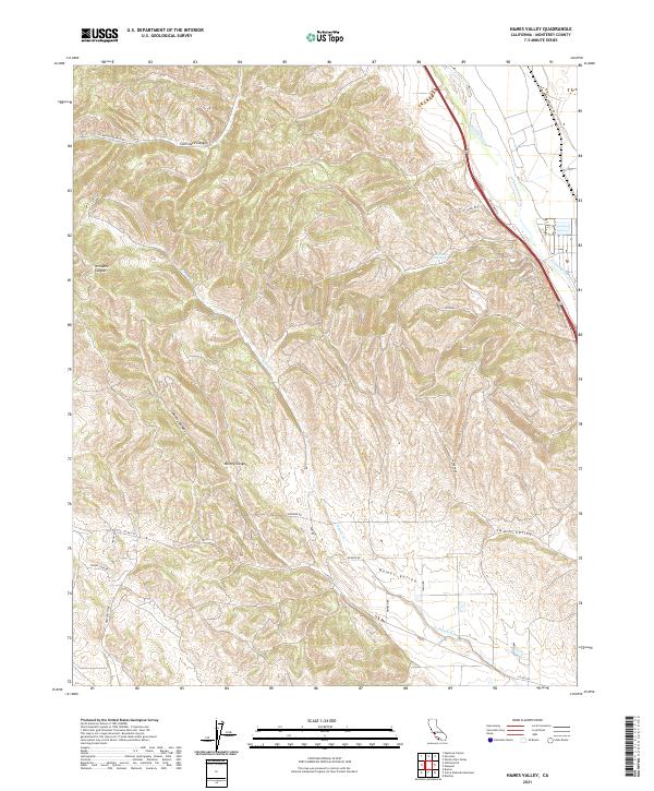
2021 Map of Hames Valley
USGS Topo · Published 2021About this map
Hames Valley and the surrounding drainage of Hames Cr define this Central Coast landscape, where high ridgelines drop sharply into the alluvial plains of the Salinas River. This modern survey reveals a network of canyons including Garrisere Canyon, Williams Canyon, and Mincey Canyon that carve through the local topography. The map illustrates a rural transport system anchored by Jolon Rd and Lockwood-San Ardo Rd, which serve the agricultural and ranching interests found in Swain Valley. Water resources are precisely mapped, from the perennial flow of the river to isolated points like Las Lobos Spring, providing a clear picture of the land's hydrology and modern road access in this portion of Monterey County.
Find a feature on this map
26 named features on this map. Tap any name to fly to it.
Don’t see what you’re looking for? This feature index may not catch every label — zoom into the map to look around manually.
Map Details
Editions of this 2021 Hames Valley Map
This is the sole edition of this map. No revisions or reprints were ever made.
Other maps of this area

1912 · San Ardo
USGS Topo · 1:31,680

1915 · Priest Valley
USGS Topo · 1:125,000

1919 · King City
USGS Topo · 1:62,500

1919 · Bryson
USGS Topo · 1:62,500

1919 · Bradley
USGS Topo · 1:62,500

1939 · King City
USGS Topo · 1:62,500

1941 · San Ardo
USGS Topo · 1:62,500

1941 · Bradley
USGS Topo · 1:62,500

1941 · Bryson
USGS Topo · 1:62,500

1942 · Bryson
USGS Topo · 1:62,500