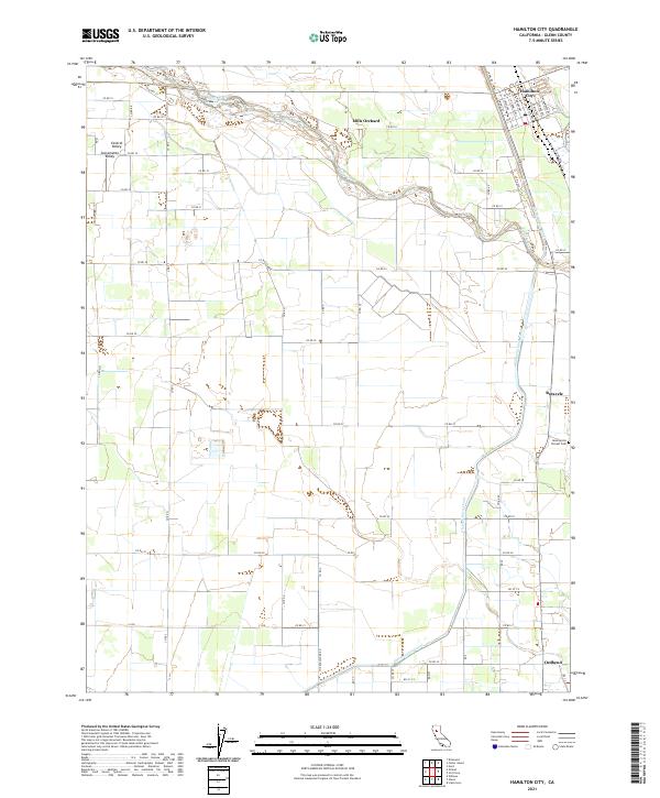
2021 Map of Hamilton City
USGS Topo · Published 2021About this map
Hamilton City anchors the northern reaches of this Glenn County landscape, situated where the Sacramento Valley meets the dynamic braided course of Stony Creek. The region is defined by its deep agricultural roots and sophisticated water management systems, notably the expansive Glenn-Colusa Canal which traverses the eastern half of the map. Traces of early California history are preserved at the Monroeville Pioneer Cem, a significant site for genealogists and local historians. Small agricultural centers and naming points such as Mills Orchard, Rotavele, and Ordbend are connected by a rigorous grid of rural roads like The Boulevard Rd. The terrain is characterized by the flat, fertile plains typical of the Central Valley, with the complex natural hydrology of the creek bed contrasting with the straight-line precision of irrigation infrastructure and township boundaries like t22n r1w.
Find a feature on this map
61 named features on this map. Tap any name to fly to it.
Don’t see what you’re looking for? This feature index may not catch every label — zoom into the map to look around manually.
Map Details
Editions of this 2021 Hamilton City Map
This is the sole edition of this map. No revisions or reprints were ever made.
Other maps of this area

1891 · Chico
USGS Topo · 1:125,000

1893 · Chico
USGS Topo · 1:125,000

1895 · Chico
USGS Topo · 1:125,000

1904 · Vina
USGS Topo · 1:62,500

1906 · Willows
USGS Topo · 1:62,500

1912 · Nord
USGS Topo · 1:31,680

1912 · Chico Landing
USGS Topo · 1:31,680
1912 · Newhard
USGS Topo · 1:31,680

1914 · Kirkwood
USGS Topo · 1:31,680

1914 · Orland
USGS Topo · 1:31,680