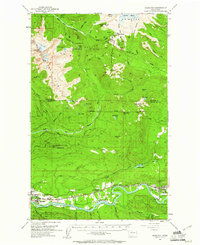
1952 Map of Hamilton
USGS Topo · Published 1961About this map
The Skagit River valley serves as the industrial and transit corridor for this region of the Mount Baker National Forest during the mid-century. Several riverfront communities, including Hamilton, Birdsview, and Concrete, are linked by the Great Northern and Northern Pacific railroads, which parallel the river's winding course. This era shows the developed valley floor in sharp contrast to the high-elevation wilderness to the north, where glaciers like Deming Glacier descend from Mount Baker. Genealogy and local history researchers will find the specific locations of the town Cem and High School in Concrete, alongside early industrial markers like the Gravel Pit and Birdsview Siding. The map also documents fire-watch infrastructure such as the Park Butte Lookout and Dock Butte Lookout on the high ridges overlooking the South Fork Nooksack River and Middle Fork Nooksack River.
Find a feature on this map
83 named features on this map. Tap any name to fly to it.
Don’t see what you’re looking for? This feature index may not catch every label — zoom into the map to look around manually.
Map Details
Editions of this 1952 Hamilton Map
3 editions found

Other maps of this area

1899 · Stillaguamish
USGS Topo · 1:125,000

1901 · Stilaguamish
USGS Topo · 1:125,000

1909 · Mt Baker
USGS Topo · 1:192,000

1911 · Mount Vernon
USGS Topo · 1:125,000

1915 · Mt. Baker
USGS Topo · 1:250,000

1919 · Van Zandt
USGS Topo · 1:62,500

1921 · Wickersham
USGS Topo · 1:62,500

1944 · Clear Lake
USGS Topo · 1:62,500

1951 · Wickersham
USGS Topo · 1:62,500

1951 · Van Zandt
USGS Topo · 1:62,500