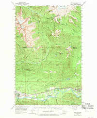
1952 Map of Hamilton
USGS Topo · Published 1970About this map
The Skagit River corridor serves as the industrial and social backbone of this mid-century landscape, where the Great Northern River railroad links the riverfront communities of Hamilton and Concrete. The town of Concrete is particularly well-defined, showing the High School, local Cem, and a nearby Airport alongside the rail line. Between these hubs, the settlement at Birdsview and its associated Birdsview Siding reflect the importance of rail transport for moving resources from the surrounding timberlands and quarries, such as the Gravel Pit near Cape Horn.
Find a feature on this map
77 named features on this map. Tap any name to fly to it.
Don’t see what you’re looking for? This feature index may not catch every label — zoom into the map to look around manually.
Map Details
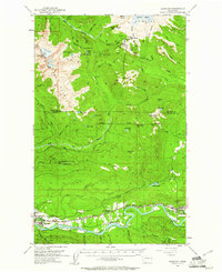
Editions of this 1952 Hamilton Map
3 editions found

Other maps of this area

1899 · Stillaguamish
USGS Topo · 1:125,000

1901 · Stilaguamish
USGS Topo · 1:125,000

1909 · Mt Baker
USGS Topo · 1:192,000

1911 · Mount Vernon
USGS Topo · 1:125,000

1915 · Mt. Baker
USGS Topo · 1:250,000

1919 · Van Zandt
USGS Topo · 1:62,500

1921 · Wickersham
USGS Topo · 1:62,500

1944 · Clear Lake
USGS Topo · 1:62,500

1951 · Wickersham
USGS Topo · 1:62,500

1951 · Van Zandt
USGS Topo · 1:62,500