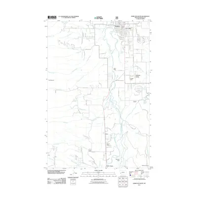
2011 Map of Hamilton South
USGS Topo · Published 2011About this map
The Bitterroot River valley south of Hamilton is defined by its agricultural layout and riverfront recreation in this 2011 topographic study. The river meanders through the center of the map, flanked by settlements like Grantsdale and residential developments such as Leisure Village and Charlas Heights. For local historians and genealogists, the map provides precise locations for the Grantsdale Cemetery and community anchors like the Hamilton Post Office and Grantsdale Post Office. To the west, the terrain rises sharply toward Goat Mountain, with numerous creeks such as Roaring Lion Creek and Sawtooth Creek draining into the valley. The presence of the Anglers Roost RV Park and Bitterroot Family Campground underscores the importance of the river corridor for seasonal residents and outdoor recreation.
Find a feature on this map
92 named features on this map. Tap any name to fly to it.
Don’t see what you’re looking for? This feature index may not catch every label — zoom into the map to look around manually.
Map Details
Editions of this 2011 Hamilton South Map
This is the sole edition of this map. No revisions or reprints were ever made.
Other maps of this area

1901 · Hamilton
USGS Topo · 1:125,000

1956 · Hamilton
USGS Topo · 1:250,000

1959 · Hamilton
USGS Topo · 1:250,000

1960 · Hamilton
USGS Topo · 1:250,000

1964 · Hamilton
USGS Topo · 1:250,000

1964 · Hamilton South
USGS Topo · 1:24,000

1964 · Darby
USGS Topo · 1:24,000

1964 · Ward Mountain
USGS Topo · 1:24,000
1964 · Como Peaks
USGS Topo · 1:24,000
1964 · Deer Mountain
USGS Topo · 1:24,000