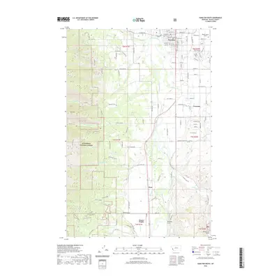
2020 Map of Hamilton South
USGS Topo · Published 2020About this map
The Bitterroot River carves a central path through this western Montana landscape, separating the residential expansion of Hamilton from the steep, forested slopes of the Bitterroot National Forest. To the west, the terrain rises sharply toward Ward Mountain and Goat Mtn, drained by a series of parallel watercourses including Roaring Lion Cr and Sawtooth Cr. These drainages cut through rugged canyons before reaching the valley floor, where the settlement patterns of Grantsdale and Ward reflect the region's agricultural and rural residential heritage.
Find a feature on this map
83 named features on this map. Tap any name to fly to it.
Don’t see what you’re looking for? This feature index may not catch every label — zoom into the map to look around manually.
Map Details
Editions of this 2020 Hamilton South Map
This is the sole edition of this map. No revisions or reprints were ever made.
Other maps of this area

1901 · Hamilton
USGS Topo · 1:125,000

1956 · Hamilton
USGS Topo · 1:250,000

1959 · Hamilton
USGS Topo · 1:250,000

1960 · Hamilton
USGS Topo · 1:250,000

1964 · Hamilton
USGS Topo · 1:250,000

1964 · Hamilton South
USGS Topo · 1:24,000

1964 · Darby
USGS Topo · 1:24,000

1964 · Ward Mountain
USGS Topo · 1:24,000
1964 · Como Peaks
USGS Topo · 1:24,000
1964 · Deer Mountain
USGS Topo · 1:24,000