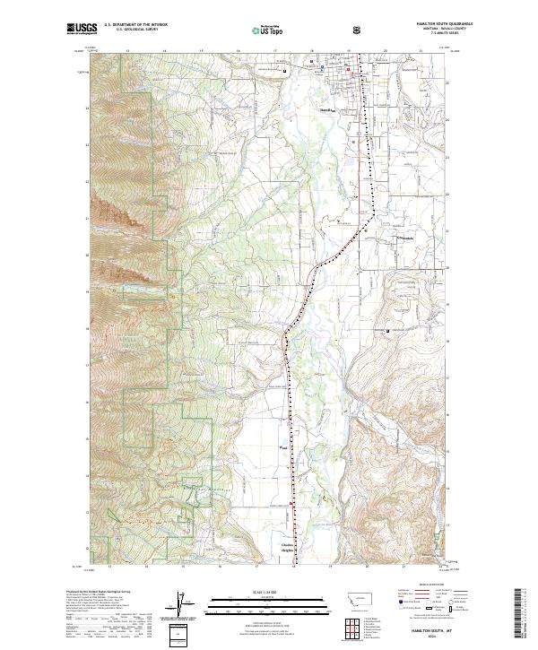
2024 Map of Hamilton South
USGS Topo · Published 2024About this map
Hamilton serves as a focal point for the Bitterroot Valley, with the Ravalli County Courthouse anchoring the town center and Bitterroot College nearby. The landscape transitions from the residential and institutional streets of the county seat toward the surrounding peaks and timberlands. The Bitterroot River threads through the valley, joined by tributaries like Skalkaho Creek and Roaring Lion Creek, reflecting a geography defined by its watercourses and the proximity of the Bitterroot National Forest.
Find a feature on this map
143 named features on this map. Tap any name to fly to it.
Don’t see what you’re looking for? This feature index may not catch every label — zoom into the map to look around manually.
Map Details
Editions of this 2024 Hamilton South Map
This is the sole edition of this map. No revisions or reprints were ever made.
Other maps of this area

1901 · Hamilton
USGS Topo · 1:125,000

1956 · Hamilton
USGS Topo · 1:250,000

1959 · Hamilton
USGS Topo · 1:250,000

1960 · Hamilton
USGS Topo · 1:250,000

1964 · Hamilton
USGS Topo · 1:250,000

1964 · Hamilton South
USGS Topo · 1:24,000

1964 · Darby
USGS Topo · 1:24,000

1964 · Ward Mountain
USGS Topo · 1:24,000
1964 · Como Peaks
USGS Topo · 1:24,000
1964 · Deer Mountain
USGS Topo · 1:24,000