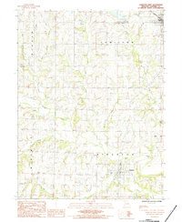
1984 Map of Hamilton West
USGS Topo · Published 1985About this map
Kingston and the southern outskirts of Hamilton anchor this Missouri landscape, which is defined by a dense network of meandering waterways. The drainage system of Shoal Creek dominates the central portion of the map, fed by numerous tributaries including Goose Creek, Mill Creek, and Jim Creek. This hydrological pattern influenced early settlement, as seen in the placement of several small family or community burial grounds such as Highland Cem, Dustin Cem, and Morris Cem.
Find a feature on this map
25 named features on this map. Tap any name to fly to it.
Don’t see what you’re looking for? This feature index may not catch every label — zoom into the map to look around manually.
Map Details
Editions of this 1984 Hamilton West Map
This is the sole edition of this map. No revisions or reprints were ever made.
Other maps of this area

1922 · Gallatin
USGS Topo · 1:62,500

1924 · Polo
USGS Topo · 1:62,500

1924 · Braymer
USGS Topo · 1:62,500

1924 · Winston
USGS Topo · 1:62,500

1950 · Kansas City
USGS Topo · 1:250,000

1953 · Moberly
USGS Topo · 1:250,000

1954 · Kansas City
USGS Topo · 1:250,000

1954 · Moberly
USGS Topo · 1:250,000

1956 · Kansas City
USGS Topo · 1:250,000

1957 · Moberly
USGS Topo · 1:250,000