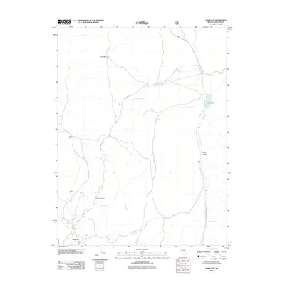
2012 Map of Hamilton
USGS Topo · Published 2012About this map
Hamilton serves as the focal point for this high-desert survey in Nevada's White Pine County. The settlement lies at the base of a complex network of mountain drainages and canyons, characterized by a scarce but vital system of named water sources. These include Waterworks Spring, California Spring, and Illipah Spring which feed into the seasonal flow of Illipah Cr. The presence of Illipah Creek Reservoir and the Illipah Campground suggests the area's modern transition toward recreational use within the national forest system.
Find a feature on this map
27 named features on this map. Tap any name to fly to it.
Don’t see what you’re looking for? This feature index may not catch every label — zoom into the map to look around manually.
Map Details
Editions of this 2012 Hamilton Map
This is the sole edition of this map. No revisions or reprints were ever made.
Other maps of this area

1949 · Treasure Hill
USGS Topo · 1:62,500

1950 · Treasure Hill
USGS Topo · 1:62,500

1951 · Green Springs
USGS Topo · 1:62,500

1951 · Illipah
USGS Topo · 1:62,500

1951 · Pancake Summit
USGS Topo · 1:62,500

1956 · Ely
USGS Topo · 1:250,000

1959 · Ely
USGS Topo · 1:250,000

1963 · Ely
USGS Topo · 1:250,000

1979 · Mt. Hamilton
USGS Topo · 1:100,000
1990 · Seligman Canyon
USGS Topo · 1:24,000