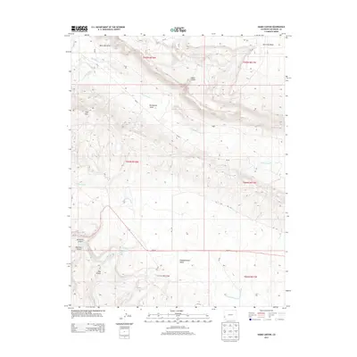
2013 Map of Hamm Canyon
USGS Topo · Published 2013About this map
The Dolores River cuts through the northwest corner of this San Miguel County landscape, defining a region of dramatic topographic shifts and deep drainages. The area is anchored by the broad Big Gypsum Valley and the neighboring Disappointment Valley, where seasonal watercourses like Big Gypsum Cr and Disappointment Cr have carved out a complex system of canyons and draws. Notable landforms such as Cape Horn and the eponymous Hamm Canyon dominate the elevation contours, illustrating the erosional history of the Colorado Plateau.
Find a feature on this map
28 named features on this map. Tap any name to fly to it.
Don’t see what you’re looking for? This feature index may not catch every label — zoom into the map to look around manually.
Map Details
Editions of this 2013 Hamm Canyon Map
This is the sole edition of this map. No revisions or reprints were ever made.
Other maps of this area

1916 · Paradox Valley
USGS Topo · 1:125,000

1922 · Paradox Valley
USGS Topo · 1:125,000

1948 · Bull Canyon
USGS Topo · 1:24,000

1948 · Horse Range Mesa
USGS Topo · 1:24,000

1948 · Hamm Canyon
USGS Topo · 1:24,000

1948 · Naturita NW
USGS Topo · 1:24,000

1948 · Gypsum Gap
USGS Topo · 1:24,000

1949 · Bull Canyon
USGS Topo · 1:24,000

1949 · Gypsum Gap
USGS Topo · 1:24,000

1949 · Naturita NW
USGS Topo · 1:24,000