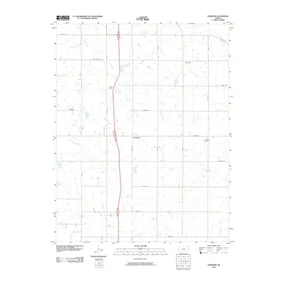
2009 Map of Hammond
USGS Topo · Published 2009About this map
Hammond serves as the central point for this section of Bourbon County, where a strictly organized grid of agricultural roads defines the Kansas landscape. The settlement is flanked by Lyons Field and the small Emmerson Airport, illustrating the continued reliance on local airstrips within rural communities. Waterways like Wolverine Creek and Moores Branch cut across the geometric property lines, providing natural drainage for the surrounding fields. Genealogists will find historical value in the presence of Glendale Cemetery and West Liberty Cemetery, which mark the community's early origins. The road network preserves traditional names such as Wagon Rd, Tomahawk Rd, and Soldier Rd, suggesting the historical pathways used before the modern thoroughfares were established. The terrain is further shaped by Shiloh Creek and Elm Creek, which wind through the northern and eastern portions of the quadrangle.
Find a feature on this map
19 named features on this map. Tap any name to fly to it.
Don’t see what you’re looking for? This feature index may not catch every label — zoom into the map to look around manually.
Map Details
Editions of this 2009 Hammond Map
This is the sole edition of this map. No revisions or reprints were ever made.
Other maps of this area

1884 · Fort Scott
USGS Topo · 1:125,000

1886 · Fort Scott
USGS Topo · 1:125,000

1887 · Mound City
USGS Topo · 1:125,000

1893 · Fort Scott
USGS Topo · 1:125,000

1893 · Mound City
USGS Topo · 1:125,000

1939 · Deerfield
USGS Topo · 1:24,000

1940 · Hume
USGS Topo · 1:24,000

1942 · Hume
USGS Topo · 1:24,000

1942 · Richards
USGS Topo · 1:24,000

1942 · Deerfield
USGS Topo · 1:24,000