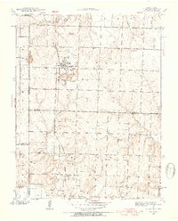
1940 Map of Hume
USGS Topo · Published 1954About this map
Hume sits at the heart of this landscape straddling the Missouri-Kansas border, captured at a time when rural education and community centers were densely distributed across the countryside. The presence of numerous district schools, such as Mt Rose Sch and Brush College Sch, alongside Union Chapel and Centerview Ch, indicates a robust network of small-scale agricultural neighborhoods. The Kansas City Southern railroad serves as the primary artery for the town, connecting it to the larger region. To the south, the smaller settlement of Amos rests near Pecan Creek, while the land is defined by a series of drainages including Duncan Creek and Pryor Creek. Local topography is highlighted by Rocky Mound, providing a clear point of orientation in an area otherwise dominated by the intersecting county lines of Bates, Vernon, Linn, and Bourbon.
Find a feature on this map
29 named features on this map. Tap any name to fly to it.
Don’t see what you’re looking for? This feature index may not catch every label — zoom into the map to look around manually.
Map Details
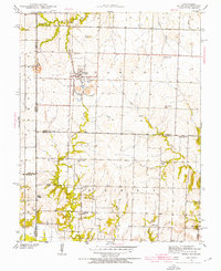
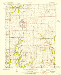
Editions of this 1940 Hume Map
3 editions found
Other maps of this area

1884 · Fort Scott
USGS Topo · 1:125,000

1886 · Nevada
USGS Topo · 1:125,000

1886 · Fort Scott
USGS Topo · 1:125,000

1887 · Butler
USGS Topo · 1:125,000

1887 · Mound City
USGS Topo · 1:125,000

1893 · Fort Scott
USGS Topo · 1:125,000

1893 · Mound City
USGS Topo · 1:125,000

1894 · Butler
USGS Topo · 1:125,000

1894 · Nevada
USGS Topo · 1:125,000
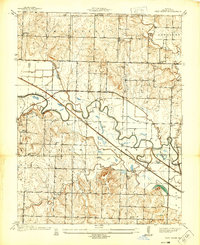
1937 · New Home
USGS Topo · 1:24,000