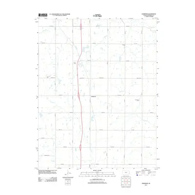
2012 Map of Hammond
USGS Topo · Published 2012About this map
The settlement of Hammond serves as the central hub of this Bourbon County landscape, situated within a dense grid of rural roads and section lines. The terrain is defined by a dendritic network of waterways, including the Little Osage River in the northeast and several smaller tributaries such as Wolverine Cr and Moores Br. This 2012 survey illustrates the modern layout of these corridors, where aviation and local history intersect at Emmerson Airport and nearby Lyons Field. Genealogists will find the locations of W Liberty Cem and Glendale Cem essential for mapping family history in this part of Kansas. The road system, including named routes like Wagon Rd and Tomahawk Rd, reflects the long-standing agricultural framework that has shaped the region's development since the early years of settlement.
Find a feature on this map
29 named features on this map. Tap any name to fly to it.
Don’t see what you’re looking for? This feature index may not catch every label — zoom into the map to look around manually.
Map Details
Editions of this 2012 Hammond Map
This is the sole edition of this map. No revisions or reprints were ever made.
Other maps of this area

1884 · Fort Scott
USGS Topo · 1:125,000

1886 · Fort Scott
USGS Topo · 1:125,000

1887 · Mound City
USGS Topo · 1:125,000

1893 · Fort Scott
USGS Topo · 1:125,000

1893 · Mound City
USGS Topo · 1:125,000

1939 · Deerfield
USGS Topo · 1:24,000

1940 · Hume
USGS Topo · 1:24,000

1942 · Hume
USGS Topo · 1:24,000

1942 · Richards
USGS Topo · 1:24,000

1942 · Deerfield
USGS Topo · 1:24,000