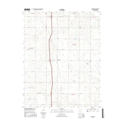
2015 Map of Hammond
USGS Topo · Published 2015About this map
Hammond serves as the central hub of this Bourbon County landscape, situated amidst a dense network of prairie tributaries and section-line roads. The terrain is defined by its watercourses, from the northern flow of the Little Osage River to the smaller drainages of Wolverine Cr, Shiloh Cr, and Moores Br. This survey reveals the enduring rural infrastructure of the region, where a series of community-anchoring burial grounds including West Liberty Cem, Glendale Cem, and Maple Grove Cem mark the historical footprint of local families. Transport patterns are a mix of traditional and modern, featuring the Emmerson Airport alongside a grid of thoroughfares such as Wagon Rd, Tomahawk Rd, and Soldier Rd. The map illustrates a classic Midwestern agricultural layout where the natural drainage of Elm Cr and Fish Cr dictates the local topography.
Find a feature on this map
30 named features on this map. Tap any name to fly to it.
Don’t see what you’re looking for? This feature index may not catch every label — zoom into the map to look around manually.
Map Details
Editions of this 2015 Hammond Map
This is the sole edition of this map. No revisions or reprints were ever made.
Other maps of this area

1884 · Fort Scott
USGS Topo · 1:125,000

1886 · Fort Scott
USGS Topo · 1:125,000

1887 · Mound City
USGS Topo · 1:125,000

1893 · Fort Scott
USGS Topo · 1:125,000

1893 · Mound City
USGS Topo · 1:125,000

1939 · Deerfield
USGS Topo · 1:24,000

1940 · Hume
USGS Topo · 1:24,000

1942 · Hume
USGS Topo · 1:24,000

1942 · Richards
USGS Topo · 1:24,000

1942 · Deerfield
USGS Topo · 1:24,000