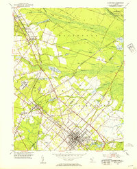
1953 Map of Hammonton
USGS Topo · Published 1954About this map
The town of Hammonton anchors this mid-century New Jersey Pinelands study, showcasing a landscape defined by the intersection of rail infrastructure and specialized agriculture. The Pennsylvania-Reading Seashore Lines and the Central Railroad of New Jersey converge at Winslow Junction, a critical node for both freight and passenger transit. This rail network supported the local economy, visible through the numerous Cranberry Bogs dotting the lowlands near Blue Anchor Brook and Gun Branch. Institutional presence is notable at the Ancora State Hospital and the nearby Leesburg Prison Farm. Small rural centers such as Waterford Works, Chesilhurst, and Elm maintain their distinct identities, often clustered around local landmarks like the Bates Mill School or the Oak Ridge Cemetery, reflecting the area's deep-rooted community history.
Find a feature on this map
54 named features on this map. Tap any name to fly to it.
Don’t see what you’re looking for? This feature index may not catch every label — zoom into the map to look around manually.
Map Details
Editions of this 1953 Hammonton Map
2 editions found
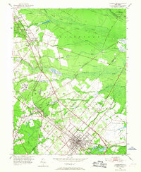
Other maps of this area

1888 · Pemberton
USGS Topo · 1:62,500

1888 · Mount Holly
USGS Topo · 1:62,500

1890 · Hammonton
USGS Topo · 1:62,500

1890 · Mullica
USGS Topo · 1:62,500

1894 · Hammonton
USGS Topo · 1:62,500

1894 · Pemberton
USGS Topo · 1:62,500

1894 · Mount Holly
USGS Topo · 1:62,500

1894 · Mullica
USGS Topo · 1:62,500

1898 · Pemberton
USGS Topo · 1:62,500

1898 · Mount Holly
USGS Topo · 1:62,500