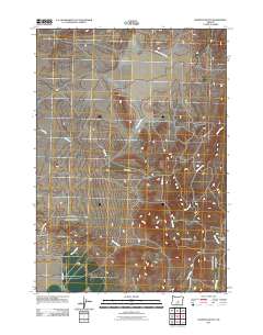
2011 Map of Hampton Butte
USGS Topo · Published 2011About this map
Hampton Butte and the wider Hampton Buttes rise as the defining elevations in this high-desert portion of Deschutes County. The landscape is etched by a series of intermittent drainage systems, most notably the Dry River which cuts through the western section of the quadrangle. Other seasonal waterways, including Gibson Creek, Clover Creek, and Hampton Creek, suggest a complex hydrological network that remains largely dry except during periods of significant runoff. Human passage through this terrain is facilitated by a few key corridors such as SE Price Twelve Mile Rd and Van Lake Rd. These routes, along with Lizard Creek Rd and Harman Rd, provide the primary access to this sparsely settled region, where the cattle-ranching landscape is defined more by its natural landmarks than by industrial development.
Find a feature on this map
12 named features on this map. Tap any name to fly to it.
Don’t see what you’re looking for? This feature index may not catch every label — zoom into the map to look around manually.
Map Details
Editions of this 2011 Hampton Butte Map
This is the sole edition of this map. No revisions or reprints were ever made.
Other maps of this area

1955 · Crescent
USGS Topo · 1:250,000

1957 · Crescent
USGS Topo · 1:250,000

1958 · Crescent
USGS Topo · 1:250,000

1970 · Crescent
USGS Topo · 1:250,000
1983 · Pringle Flat
USGS Topo · 1:24,000

1983 · Hampton Butte
USGS Topo · 1:24,000

1983 · Imperial Valley South
USGS Topo · 1:24,000
1983 · Gerry Mtn
USGS Topo · 1:24,000

1983 · West of Hampton
USGS Topo · 1:24,000
1983 · Imperial Valley North
USGS Topo · 1:24,000