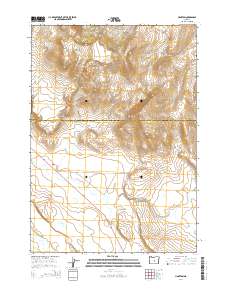
2014 Map of Hampton
USGS Topo · Published 2014About this map
Hampton serves as the focal point of this high-desert landscape at the boundary of Crook and Deschutes counties. The settlement is oriented along the path of Us-20, a critical transportation artery that cuts across the arid basin. To the north, the terrain rises into the Hampton Buttes, which dominate the upper portion of the survey. The drainage of the S Fork Crooked River meanders through the lower elevations, reflecting the seasonal water patterns of this central Oregon interior. Local transit is further defined by Schraeder Rd, which extends eastward from the highway into the open range. The map illustrates a sparse, wide-open settlement pattern typical of the region's ranching and transit-oriented development.
Find a feature on this map
10 named features on this map. Tap any name to fly to it.
Don’t see what you’re looking for? This feature index may not catch every label — zoom into the map to look around manually.
Map Details
Editions of this 2014 Hampton Map
This is the sole edition of this map. No revisions or reprints were ever made.
Other maps of this area

1955 · Crescent
USGS Topo · 1:250,000

1957 · Crescent
USGS Topo · 1:250,000

1958 · Crescent
USGS Topo · 1:250,000

1970 · Crescent
USGS Topo · 1:250,000

1983 · Potato Lake
USGS Topo · 1:24,000

1983 · Hampton Butte
USGS Topo · 1:24,000

1983 · Benjamin Lake
USGS Topo · 1:24,000

1983 · West of Hampton
USGS Topo · 1:24,000
1983 · Hampton
USGS Topo · 1:24,000
1983 · G.I. Ranch
USGS Topo · 1:24,000