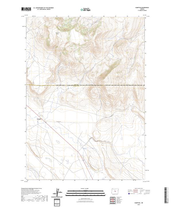
2023 Map of Hampton
USGS Topo · Published 2023About this map
Hampton sits at a high-desert crossroads along the southern edge of this Central Oregon survey, serving as a focal point for a landscape defined by expansive public and private lands. The terrain is dominated to the north by the Hampton Buttes, which rise significantly above the surrounding basin. This 2023 edition traces the boundary of Crook Co and Deschutes Co as it cuts across the high plateau, marking the transition between these two administrative regions. Local infrastructure is sparse, characterized primarily by Schraeder Rd and the primary east-west highway, highlighting the remote nature of the settlement patterns in this part of the state. The map provides a clear view of the Public Land Survey System grids, including t21s r21e and t22s r21e, which are essential for property research and historical land use studies.
Find a feature on this map
8 named features on this map. Tap any name to fly to it.
Don’t see what you’re looking for? This feature index may not catch every label — zoom into the map to look around manually.
Map Details
Editions of this 2023 Hampton Map
This is the sole edition of this map. No revisions or reprints were ever made.
Other maps of this area

1955 · Crescent
USGS Topo · 1:250,000

1957 · Crescent
USGS Topo · 1:250,000

1958 · Crescent
USGS Topo · 1:250,000

1970 · Crescent
USGS Topo · 1:250,000

1983 · Potato Lake
USGS Topo · 1:24,000

1983 · Hampton Butte
USGS Topo · 1:24,000

1983 · Benjamin Lake
USGS Topo · 1:24,000

1983 · West of Hampton
USGS Topo · 1:24,000
1983 · Hampton
USGS Topo · 1:24,000
1983 · G.I. Ranch
USGS Topo · 1:24,000