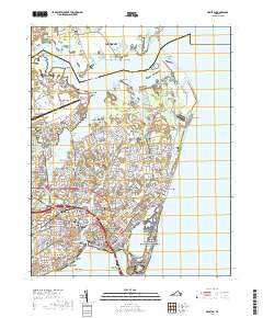
2019 Map of Hampton
USGS Topo · Published 2019About this map
Fort Monroe National Monument and the historic grounds of Hampton National Cemetery anchor the southern peninsula of this coastal Virginia landscape. The maritime character of the region is defined by the intricate waterways of the Back River, Hampton River, and the Hampton Roads Bridge-Tunnel corridor. To the north, the sprawling marshes of Plum Tree Island National Wildlife Refuge contrast with the heavy military footprint of Langley Air Force Base. Residential developments like Buckroe Beach, Fox Hill, and Sinclair Farms trace the evolution of the city's neighborhoods around established institutions such as Hampton University and the Hampton City Courthouse. This survey details the transition from the dense urban grid of Hampton to the tidal creeks and points of Poquoson, illustrating the balance between strategic military installations and residential waterfront life.
Find a feature on this map
108 named features on this map. Tap any name to fly to it.
Don’t see what you’re looking for? This feature index may not catch every label — zoom into the map to look around manually.
Map Details
Editions of this 2019 Hampton Map
This is the sole edition of this map. No revisions or reprints were ever made.
Other maps of this area

1907 · Norfolk
USGS Topo · 1:125,000

1907 · Hampton
USGS Topo · 1:62,500

1918 · Cape Henry
USGS Topo · 1:62,500

1919 · Cape Henry
USGS Topo · 1:62,500

1921 · Newport News
USGS Topo · 1:62,500

1943 · Richmond
USGS Topo · 1:250,000

1944 · Hampton
USGS Topo · 1:24,000

1944 · Messick
USGS Topo · 1:24,000

1944 · Morrison
USGS Topo · 1:24,000

1944 · Harris Grove
USGS Topo · 1:24,000