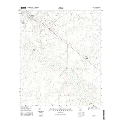
2017 Map of Hampton
USGS Topo · Published 2017About this map
Hampton and its neighbor Varnville anchor the landscape of Hampton County, where the street grids give way to the sprawling wetlands of the Coosawhatchie River basin. This survey shows the transition from the organized residential blocks and the Hampton-Varnville Airport to the more dispersed rural crossings like Tütens Crossing and Hickory Hill Crossing. The area is characterized by a dense network of watercourses, including Sanders Br, House Fork, and Camp Br, which feed into the primary river system. Local genealogy and land history are preserved in the locations of Peeples Cem, Thames Cem, and Smith Cem, clustered around the southern reaches near Lowndes Lake. The map details the local infrastructure, from the prominent corridor of US Highway 278 to the secondary roads leading to small settlements like Almeda and Camp Branch near the Jasper County line.
Find a feature on this map
132 named features on this map. Tap any name to fly to it.
Don’t see what you’re looking for? This feature index may not catch every label — zoom into the map to look around manually.
Map Details
Editions of this 2017 Hampton Map
This is the sole edition of this map. No revisions or reprints were ever made.
Other maps of this area

1918 · Varnville
USGS Topo · 1:62,500

1918 · Yemassee
USGS Topo · 1:62,500

1919 · Pineland
USGS Topo · 1:62,500

1919 · Cummings
USGS Topo · 1:62,500

1943 · Pineland
USGS Topo · 1:62,500

1943 · Yemassee
USGS Topo · 1:62,500

1943 · Cummings
USGS Topo · 1:62,500

1944 · Varnville
USGS Topo · 1:62,500

1947 · Savannah
USGS Topo · 1:250,000

1948 · Savannah
USGS Topo · 1:250,000