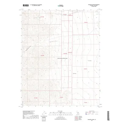
2018 Map of Hanaupah Canyon
USGS Topo · Published 2018About this map
Death Valley National Park encompasses this high-elevation desert landscape, where steep topography transitions from the Panamint Range down toward the salt flats of Death Valley. This 2018 survey documents a series of dramatic drainages, most notably Hanaupah Canyon and its South Fork, which have carved deep paths through the terrain. Further north, Chuckwalla Canyon offers another significant geological feature, while Starvation Canyon marks the southern reaches of the sheet. For those interested in historical water sources in this arid environment, the map identifies Tule Spring in the northeast, a critical landmark within the broader Mojave Desert expanse. The intricate contour lines provided by the U.S. Geological Survey illustrate the extreme vertical relief characteristic of this part of Inyo County, showing the complex watershed systems that feed into the valley floor.
Find a feature on this map
19 named features on this map. Tap any name to fly to it.
Don’t see what you’re looking for? This feature index may not catch every label — zoom into the map to look around manually.
Map Details
Editions of this 2018 Hanaupah Canyon Map
This is the sole edition of this map. No revisions or reprints were ever made.
Other maps of this area

1908 · Furnace Creek
USGS Topo · 1:250,000

1908 · Ballarat
USGS Topo · 1:250,000

1910 · Furnace Creek
USGS Topo · 1:250,000

1913 · Ballarat
USGS Topo · 1:250,000

1948 · Death Valley
USGS Topo · 1:250,000

1952 · Furnace Creek
USGS Topo · 1:62,500

1952 · Bennetts Well
USGS Topo · 1:62,500

1952 · Telescope Peak
USGS Topo · 1:62,500

1952 · Emigrant Canyon
USGS Topo · 1:62,500

1954 · Death Valley
USGS Topo · 1:250,000