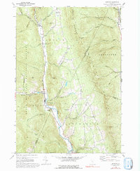
1970 Map of Hancock
USGS Topo · Published 1992About this map
White River flows through a deep valley corridor in the Green Mountains, anchoring a chain of Vermont settlements including Granville, Lower Granville, Hancock, and Rochester. This 1970 survey reveals a landscape where steep terrain has dictated a linear pattern of human activity along the valley floor and its immediate tributaries like Patterson Brook and Thatcher Brook. The heights of the Northfield Mountains and Braintree Mountains flank the valley, crossed only by primitive routes like the Jeep Trail through Braintree Gap.
Find a feature on this map
52 named features on this map. Tap any name to fly to it.
Don’t see what you’re looking for? This feature index may not catch every label — zoom into the map to look around manually.
Map Details
Editions of this 1970 Hancock Map
3 editions found
Other maps of this area

1915 · Rochester
USGS Topo · 1:62,500

1917 · Rochester
USGS Topo · 1:62,500

1919 · Royalton
USGS Topo · 1:62,500

1919 · Lincoln Mountain
USGS Topo · 1:62,500

1920 · Lincoln Mountain
USGS Topo · 1:48,000

1921 · Lincoln Mountain
USGS Topo · 1:62,500

1922 · Barre
USGS Topo · 1:48,000

1924 · Barre
USGS Topo · 1:62,500

1924 · Randolph
USGS Topo · 1:48,000

1926 · Randolph
USGS Topo · 1:62,500