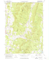
1973 Map of Hancock
USGS Topo · Published 1975About this map
The Taconic Mountains dominate this borderland landscape, where the ridge line serves as the political boundary between Rensselaer County, New York, and Berkshire County, Massachusetts. In the valley, the settlement of Hancock is anchored by the Hancock Central Sch, while the rural outskirts are defined by a network of creeks including Kinderhook Creek and the West Branch Green River. Evidence of early transportation and industry is visible in the Old Railroad Grade and numerous Gravel Pits scattered near Stephentown. The area's mid-century recreational shift is clear, with the establishment of the Brodie Mtn Ski Area and Jiminy Peak Ski Area alongside conserved lands like the Forbush Wildlife Sanctuary and Pittsfield State Forest. For genealogists, the map identifies several small burial grounds, including St Josephs Cem, alongside high-elevation landmarks such as Misery Mountain and Rounds Mountain.
Find a feature on this map
62 named features on this map. Tap any name to fly to it.
Don’t see what you’re looking for? This feature index may not catch every label — zoom into the map to look around manually.
Map Details
Editions of this 1973 Hancock Map
3 editions found
Other maps of this area

1886 · Greylock
USGS Topo · 1:62,500

1886 · Becket
USGS Topo · 1:62,500

1888 · Becket
USGS Topo · 1:62,500

1888 · Berlin
USGS Topo · 1:62,500

1888 · Pittsfield
USGS Topo · 1:62,500

1890 · Pittsfield
USGS Topo · 1:62,500

1890 · Berlin
USGS Topo · 1:62,500

1891 · Greylock
USGS Topo · 1:62,500

1893 · Becket
USGS Topo · 1:62,500

1893 · Greylock
USGS Topo · 1:62,500