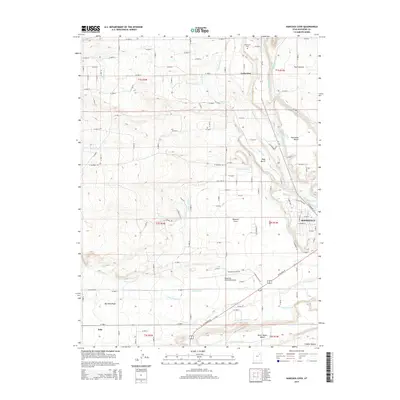
2014 Map of Hancock Cove
USGS Topo · Published 2014About this map
Roosevelt sits at the eastern edge of this terrain, where the high plateaus of Duchesne County transition into an intricate network of irrigation canals and agricultural benches. The landscape is defined by its water management systems, including the Cedarview Canal, Page Canal, and Hancock Lateral, which transform the arid lands around Harmston Bench and Page Bench into productive acreage. These engineering efforts supported the growth of local settlements such as Cedarview, where the Cedarview Cem remains as a focal point for genealogical research. To the south, the Roosevelt Municipal Airport and the seasonal flows of Dry Gulch Cr mark the outskirts of town, while prominent landforms like The Crescent and North Myton Bench overlook the sprawling valley floor. The map reflects a century-long commitment to reclaiming the desert through coordinated lateral and canal networks.
Find a feature on this map
75 named features on this map. Tap any name to fly to it.
Don’t see what you’re looking for? This feature index may not catch every label — zoom into the map to look around manually.
Map Details
Editions of this 2014 Hancock Cove Map
This is the sole edition of this map. No revisions or reprints were ever made.
Other maps of this area

1885 · Ashley
USGS Topo · 1:250,000

1885 · Uinta
USGS Topo · 1:250,000

1917 · Vernal
USGS Topo · 1:125,000

1939 · Duchesne
USGS Topo · 1:125,000

1954 · Salt Lake City
USGS Topo · 1:250,000

1954 · Vernal
USGS Topo · 1:250,000

1958 · Vernal
USGS Topo · 1:250,000

1958 · Salt Lake City
USGS Topo · 1:250,000

1960 · Salt Lake City
USGS Topo · 1:250,000

1960 · Vernal
USGS Topo · 1:250,000